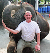
I have been mentally preparing for my second
competition at the Huntsman World Senior Games since last October. I have
practiced my archery daily, and I have improved. Anne, too, is prepared for the
doubles tennis games she will play with her partner, Judy. Over the many years
they have played together at these contests, they have done well.
The first day’s drive towards St George,
Utah, took us from Medford to Fallon, NV. Fallon is a small city on Hwy 50
southeast of the I-80 freeway and hustle and bustle of Reno. Fallon is a
military town and is host to the Fallon Naval Air Station. This had been an
eight hour day in our Freeway Cloud and both of us were ready for a break.
Fallon RV Park is at the northern fringe of
the city, well presented, and convenient to the highway. The early evening sky
was just beginning to darken as we registered and found our way to site 22. On
previous trips to the SW we had stayed in Fallon. In a car, the time to reach
Fallon is only about five hours and the busy home of the Naval Air Station
breaks the trip to St George in half.
Reservations had been made to stay at the
Willow Winds RV Park in Hurricane, UT. The Senior Games are held in and about
St George, but unless one books an RV spot a half year early there are no
spaces available within the city limits. The city of Hurricane, pronounced
locally as Hurricun, is eight miles east of St George on I-15, and about ten
miles south of exit 16 on UT-9.
The Virgin River was the source of water for
the cotton fields Brigham Young was going to develop in this western Land of
Dixie. I-15 doesn’t faithfully follow the course of the Virgin River, but the
early Latter Day Saints did. Nestled by the river and at the base of a large
range of mesas to the south, the valley was a perfect place to form a new
settlement. I don’t think the city’s name was any accident. The winds often
blew stiffly and would rock the RV late into the night.
We pulled into Willow Winds on the fifth of
October and we stayed until the seventeenth. Although we were a ways away from
our sporting activities, the park was a good hub for us. All we needed to do
was account for an extra half hour travel time in our schedules.
Anne and Judy were occupied with their
matches on the same days I had my archery. Anne dropped me off at the archery
field at around 0830 and then drove to Judy’s home in Sunriver, off Exit 2,
west of St George. We arranged to have me recollected around 1630, after I had
finished each long day of shooting.
Anne and Judy were defeated in a tie-breaker
during their grab for bronze. Anne had played the last minutes of their match
with a pulled calf muscle. She didn’t complain about her pain at the time, but
I know if she had been able to work her court with a focused mind, they would
have worn home metals.

I, with an honest outlook, saw no metal in my
future on the field. Day one was organized for practice and setting sights for
the 60, 50, and 40 yard ranges. St George lays at about 3,500 feet elevation.
This is only 2,000 feet more that I have been shooting, in Medford. I noticed
that my arrows were striking the target a few inches high. Two thousand feet
isn’t much, but the lower air density can cause this effect. I shot several
ends at each of the three range distances and established new sight settings.
Day two was spent in the southern Utah sun
for eight hours. The field had 32 targets set up. Each target had four archers
assigned. The four archers shot in pairs, an A line and a B line. The archers
took five minute turns at hitting their assigned targets. After both lines have
shot their six arrows, they all walk to the target to score the end and pull
their arrows. As soon as all the archers have left the field, a whistle is
blown and each archer shoots six more arrows. Thirty arrows are shot at each of
the three target distances. When 60 yards is complete, the teams bring their
target butts up to the 50 yard marker. At the new distance there is an end shot
by each archer as practice. Thirty arrows are then shot before the target butts
are pulled to the 40 yard line. I was dragging my quiver by the time Anne
picked me up.

Day three on the range was greeted with winds
of 20mph, gusting to 28mph. I, and most of the other archers, had never
experienced shooting in these conditions. We mused about how no archer,
excepting those who may have fallen subject to ancient military courts martial,
would have been spending such a day shooting arrows. Needless, I didn’t shoot
well this day. Miller Time seemed very slow to come and I was glad to have my
year two of the Huntsman World Senior Games under my belt, along with the
contents of a cold tinnie.
At this point neither of us had any scheduled
expectations. Anne brought out her sewing machine and I read and putzed around
the rest of the week. Patti Stanalonis was flying in with her softball team,
from Albuquerque, on Sunday. We stayed through Wednesday so we could watch a
few of the games her team played while on their way to a well-earned Bronze for
this year’s work.
 |
| Glen Canyon Dam |
Thursday morning we pulled out of Willow
Winds and drove south and east towards Chinle, AZ. We planned to arrive at
Cottonwood Campground at Canyon De Chelly (pronounced Shay) later in the day,
set up a base, tour the canyon the next day, and drive the remainder of the way
to Albuquerque on Saturday. We over shot our turn off and drove a few miles beyond
before we could find an opportunity to turn our large RV and towed Honda CRV
around. We asked directions to the campground from a Navajo street vender and
quickly found our way to the park; the directions hadn’t been posted for the
campground when coming from the Chinle direction.
There was no one manning the check-in booth
when we arrived at Cottonwood. We selected site 41, paid our $14 daily fee and
pulled in. Cottonwood has over ninety paved parking slots. Number 41 was large
enough for us to pull directly into. The campground had few visitors the two
days we were there. It is nicely kept with plenty of shade trees protecting the
all-natural landscaping. The daily fee of $14 was pleasant, but no hookups came
with it. The RV’s diesel generator powered the microwave for dinner preparation
and saw us till the 2030 campground quiet hour when we had to turn it off,
along with the TV.

With over 17 million acres, the Navajo Nation
encompasses the entire northeast quarter of the state of Arizona and spills over
into New Mexico and Utah. Vast areas of pristine wilderness, majestic canyons,
high mountain meadows, dry deserts, flatlands and blue skies characterize the
land of the Navajo people.
Canyon De Chelly is two vertical walled
canyons carved some 800 feet into a high desert mesa of Arizona beginning a
couple miles east of Chinle. The canyons spread out to form a Y-formation with
the base anchored on the map at Chinle. There are two rim drives with pull-over
lookouts offering spectacular vistas of the agriculturally worked base of the
canyon; home for many of the area’s Navajo.

Each rim drive, one to the northeast and one
to the southeast, has eight lookouts. From some of the lookouts one can park
and then walk trails to the edge of the wall. On the far side, often quite high
on the opposite cliff, one can see ruins of ancient wall dwellings occupied by
the ancestors of the basin’s more modern timber framed citizens. History of
human habitation within the canyon dates back to times BC.
The SE rim drive was the more convenient one from
the Cottonwood Campground. In fact, it was on this rim where, the day before,
we had used one of the lookout pull-overs to re-direct ourselves to the RV
park. The lookouts were sprinkled along the rim drive over a distance of 14
miles. We took our time and checked out the views from each one. The most
spectacular stop was at the last one where we were able to stand at the rim and
look eye-to-eye with the top of Spider Rock.

We have all seen the TV commercial where a
woman stands at the top of a spire, gleefully spinning around while waving at
the abundance of sights to see when using her Visa card. The top Spider Rock is
her stage. Believe me. She did not reach the top by ascending the nearly 800
feet of this sheer vertical and smoothly sided stone without rotorcraft
assistance. A fantastic sight, the stone stands beside a shorter off-spring in
the middle of the Canyon De Chelly basin. It is amazing to consider that the
weathering process, which carved this beautiful canyon, had come to such a
well-defined mass of erosive resistance when it came to this plug of stone.

Walking the gentle trail along the edge of
the canyon at the Spider Rock lookout was the height of our visit to Canyon De
Chelly. Most of the lookout parking lots had one or more vendors displaying their
hand-crafted jewelry on blankets they had spread over the hoods of their cars, or
pastels they had painted on small slabs of sandstone and placed neatly on the
ground near the edge of the sidewalk. The paintings depicted traditional Navajo
icons, or scenes remembering a feature of the canyon. Yes, we found some
jewelry, and a painting that couldn’t be passed up.
We didn’t have time to also tour the
northeastern rim lookouts. We were satisfied we had seen much of the best there
was to see of the diverse canyon’s sights.

The next morning we were early to pull away
from the campground. Our intent today is to reach our friends, Patti and ‘Stan’
Stanalonis, in Albuquerque by the middle of the afternoon. This leg of the trip
was only a couple hundred miles and we weren’t in any great rush. I have
learned that fuel economy is maximized with the Horizon diesel pusher when the 350hp
Cummins’ rpm is kept at its ‘sweet spot’. For us, that was just shy of 1500 rpm,
which happens when our speed was kept at 55 mph. This has been our cruising
speed, back road or freeway.
Most of the off freeway travel through
Nevada, Arizona, and New Mexico is over high desert plateau highways which have
been carved straight as arrows between one mountain ridge to the next. The road’s
gentle undulation creates opportunities for the 6-speed automatic transmission
to shift into and out of a lower gear range. This, in turn, permits the Cummins
a short window of higher revolution and destruction of our previously achieved
miles per gallon records. On cruise control, and with a steering wheel gently
gripped by a hand braced with softly contoured leather armrests, the miles
drifted by at between 8 and 10mpg
There is, however, much to be desired about
the outback’s highway construction. Many of these roads have been newly
resurfaced. Some, however, as were the ones we found ourselves on this morning,
must have been worked upon by a tribe of the Navajo who go by the name: Clan of
the Road Painters. This clan’s vocation is to spread streaks of tar onto the
highway and seal cracks which have formed due to the ever expanding and contracting
substrate below the pavement. The result of this clan’s hard labor is hundreds
of miles of brain numbing vibration interrupted by short respites of newly
resurfaced roadway.
Albuquerque Central KOA Campground is
immediately south of I-40 at the Juan Tabo exit. We were assigned to site 121
and in a few minutes were set up for a week’s stay.
Albuquerque’s roads are laid out on a
rectangular grid. This architecture makes it a very convenient town to navigate.
Juan Tabo runs north and south for several miles. Patti and Stan’s home is just
3.2miles north of the KOA, off Comanche Road. I abhor metropolitan traffic
environments. I have to admit, however, the driving experience in Albuquerque
is very non-threatening.
We have been friends for many years and we
wouldn’t think of traveling in the SE without visiting Patti and Stan. Stan and
I couldn’t have been in better hands. Anne and Patti mapped out excellent ideas
for things for us to see and do while we visited the southeastern part of New Mexico.
Anne and I decided that since we may never again
travel so close we should visit Carlsbad Caverns. A three day trip was mapped
out that would take us to The Inn of the Mountain Gods at White’s City, a few
miles outside of Ruidoso, NM. We would stay at the Inn following the day’s
drive to Ruidoso. The next day we would drive to Carlsbad, spend the day
visiting the caverns, and return to the Inn for a second night. The third day
we would return to Albuquerque, via Alamogordo.
We met at Patti and Stan’s for breakfast and
packed the back of Anne’s CRV for the journey. Stan drove the first leg south
on I-25 which took us past Socorro, where one could turn off if he wanted to
visit the National Radio Observatory VLA Telescope. Last year, when I
caravanned in the Vanaroo with Dave, Joy, Chris, Jennifer, and the boys, we got
to visit the very large array observatory. It was definitely impressive.

San Antonio is eleven miles south of Socorro and
Stan turned eastward on Hwy 380. Four miles from San Antonio we came to a
traffic stop. At 1100 there was going to be a missile launch from somewhere
near Gallup and the missile was programmed to land in the White Sands desert. Hwy
380 takes one past the White Sands Missile Range and Trinity Site, which is
home of the first explosion of an atomic bomb. Police officers dispatched from the
White Sands’ base set up roadblocks for the routine missile reliability tests.
The roadblocks leave deserted a 16 mile stretch of Hwy 380 for the flyover. The
launch had been delayed half an hour so we got to visit with the officers and
inspect the roadside desert flora. Drats.
None of us spotted the flyover.
Our only scheduled stop today was to be at
the Smokey Bear Museum located in Capitan. It had been after a fire in the
Capitan forests that a Ranger had found Smokey the Cub clinging low on a tree
trunk. Smokey had suffered some small amount of injury during the blaze so the
Ranger took him to a shelter for healing. Smokey was later flown to the
Washington Zoo, in Washington D.C. It was while he lived at the zoo that Smokey
Bear became the World’s icon in the effort to prevent man caused forest fires.
Smokey lived to the age of 26 and was buried in a garden spot at the Capitan
museum. This had been a fun and relaxing break in the day.

The city of Ruidoso is a few miles south of
Capitan. The city is carved out of rolling hills which are part of the
Mescalero Apache Tribe’s reservation. Ruidoso is a wintertime skier’s haven,
hosted by 12,003 foot high Sierra Blanca Peak, and a year-round artisan village
akin to that of Taos. The shops of Ruidoso were going to be must see for Anne
and Patti.
The Inn of the Mountain Gods Resort and
Casino is a few miles out of Ruidoso and close to a small town called White’s
City. The very stately resort popped into sight suddenly when rounding a bend
in the curvy mountain road. We were assigned close-by rooms on the 7th
floor. Each room had a balcony overlooking the mountainside golf course, an
adjoining lake, and a distant view of Sierra Blanca Peak. After unpacking the
ladies dismissed themselves for a quick checkout of the casino. Stan and I
chose to share a couple of tinnies while resting ourselves in the sun warming his
balcony. We shared work experience stories and enjoying the magnificent
scenery.

As dinner time rolled around we found
ourselves at the casino’s buffet. The meal selection choices didn’t strike us
as being as diverse as we had looked forward to. We were in agreement that this
would be are last meal at that restaurant. A few slot machines needed to be
tested on the way back to our rooms. We all enjoyed an early turn-in to ready
us for a busy day tomorrow.
The drive to Carlsbad took us over more mountains
and across more vast savannahs. We
passed through small roadside villages such as Hondo and Tinnie, which was my
personal favorite; Roswell and Artesia are both large cities at crossroads with
major New Mexico highways.

The name Roswell is synonymous with UFOs. An
airborne object crashed on a ranch near Roswell, New Mexico, in June or July,
1947. Explanations of what took place are based on both official and unofficial
communications. Although the crash is attributed, by the U.S. government, to a
U.S. military surveillance balloon, the most famous explanation of what
occurred is that the object was a spacecraft containing extraterrestrial life.
Since the late 1970s, the Roswell incident has been the subject of much
controversy and conspiracy theories.
Religion, politics, and Roswell are areas of
conversation guaranteed to solicit audience participation. So it happened that
many miles of this morning’s three hour drive to Carlsbad were swept away
unnoticed, consumed with our own theories of what really may have happened near
Roswell.
During the late 1800s Eddy County, New Mexico
was largely know as cattle country. In
1902, Carlsbad Caverns were discovered. How the caves were actually discovered
is a bit disputed, but the most accepted story attributes the finding to Jim
White. As the story goes, Mr. White was looking out over the rolling hillsides
adjoining his share of Eddy County and he spotted smoke rising in the
distance. White set off to investigate
the cause of the dark spire. When he arrived closer he could see that what
appeared to have been smoke was actually a vast number of bats escaping a hole
in the ground. The rest is history.

The caves, located in the Guadalupe
Mountains, are now known as Carlsbad Caverns National Park. Jim White spent
many years investigating the vast network of caves. He is attributed to naming
most of the rooms in the caverns and to bringing the Carlsbad Caverns to
national attention.
We arrived shortly after 1300. Guided tours
for the day had ended but we could still do a self-tour of the Big Room. The
Big Room is a natural limestone chamber which is almost 4,000 feet long, 625
feet wide, and 255 feet at the highest point. It is the third largest chamber
in North America and ranks seventh in the world.

A little while ago, some 250 million years,
the area surrounding Carlsbad Caverns National Park served as the coastline for
an inland sea. Present in the sea was a plethora of marine life, whose remains
formed a reef. In time, the sea had evaporated and the reef was buried under
sediments.
The Park sits in a bed of limestone above
groundwater level. During cavern development, however, the limestone bed was
within the groundwater zone. Deep below the limestone are petroleum reserves
(part of the Mid-Continent Oil Field). At a time near the end of the Cenozoic,
hydrogen sulfide (H2S) began to seep upwards from the petroleum into the
groundwater. The combination of hydrogen sulfide and oxygen from the water
formed sulfuric acid: H2S + 2O2 → H2SO4. The sulfuric acid then continued
upward, aggressively dissolving the limestone deposits to form caverns. The
presence of gypsum, a byproduct of the reaction between sulfuric acid and
limestone, is a confirmation of the occurrence of this process.
Once the acidic groundwater drained from the
caverns, speleothems (where is John Mignone when you need him) began to be
deposited within the cavern. During the last million years erosion processes
occurring above ground created the natural entrance to the Carlsbad Caverns. Exposure
to the surface has allowed for the influx of air into the cavern. Rainwater and
snowmelt percolating downward into the ground picked up carbon dioxide. Once
this water reached a cavern ceiling it precipitated and evaporated leaving
behind a small calcium carbonate deposit. Growths from the roof downward formed
through this process are known as stalactites. Additionally, water dripped onto
the floor of the caverns contained carbonic acid and generate mineral deposits when
it evaporated. Growths from the floor upward through this process are known as
stalagmites. Different formations of speleothems include columns, soda straws,
draperies, helictites, and popcorn. Changes in the ambient air temperature and
rainfall affect the rate of growth of speleothems, as higher temperatures
increase carbon dioxide production rates within the overlying soil. The color
of speleothems is determined by trace amounts of different minerals in the
formation.

Hold on there, Bob. That’s a little more
geology than we really needed to know. The short version is that the Big Room
consumed an hour and half of walking on well railed paths which took us past
spectacular stony things cleverly highlighted in the, otherwise beyond just
dark, cave. The vastness of this cave
network is unbelievable. The park contains additional networks of caverns White
never knew existed. Many of those caverns are closed to public viewing and are
reserved for scientific research only.
It was early evening by the time we returned
to the Inn of the Mountain Gods for our last night’s stay. In the morning we
were going to drive to Alamogordo on our way home to Albuquerque. We had worked
hard while in the Caverns today and the beds were welcomed.
Alamogordo is the gateway to White Sands
Proving Grounds and home of the New Mexico Museum of Space History. Inside and
outside of the museum is displayed the history of the World’s missile and
rocket development. From Copernicus to John Glen and beyond: artifacts and
descriptions of achievers in the rocket sciences from all corners of the globe
are presented in this four story building.

As one sees when visiting places like the
Smithsonian buildings in Washington, there is just too much to take in on one
time-limited visit. The Museum of Space History is the same. Knowing such
museums exist, and having had a glimpse of them, leaves one the opportunity to
have reflections on the true greatness of man’s inventions; born out of both
curiosity and survival.
Jack and Margie Mortley are very dear friends
of Patti and Stan. Jack is the person I had bought the Triumph Stag from in
2006. Anne and I wanted to have an opportunity to visit with all of them
together. Anne decided she would like to use the crock pot to prepare a
chicken-chili dinner on Saturday and have them share it with us in the RV.
The meal and the evening were great
successes. Jack and Margie also have a motorhome and they enjoyed looking ours over
and sharing a few of their travel experiences. I asked Jack what special cars
he still had in his barn and he told me of a classic Saab he wouldn’t mind
selling me. We all pretty much agreed that the sale wouldn’t go through.
Patti and Stan had us over the next day for a
brunch. Anne and Patti dashed off to visit a quilting outlet store at least
that was their story. Later in the afternoon we were called and told they were
having a wonderful time at the Route 66 Casino and that they would meet us
later at a Nob Hill restaurant. That was ok. Stan and I had been watching NFL
football and we were happy to let them buy us dinner with their winnings.
The restaurant on Nob Hill, in an original
section of Albuquerque, is located on Central Avenue. Central is a section of
the old Route 66 highway. A softball friend of Patti’s is a singer who was
performing tonight with her band. We had a wonderful final meal together. But
now it is time to return to the KOA and prepare for tomorrow’s early departure towards
home.

We planned on a fairly short drive for our
first day heading northwesterly back to Medford. I was only a couple hundred
miles to Durango, CO. The initial miles took us through some very familiar
territory. We exited I-25 at a city called Bernalillo, NM.
When I caravanned with Dave, Joy, Chris,
Jennifer and the boys a year and half ago we had stayed at an RV park in
Bernalillo. This park was alongside the Rio Grande river and if afforded us a
great couple of days. Further along Hwy 550N, during that same trip, we had
found a remote BLM trailhead parking area located several miles up a bumpy dirt
road near the Zia and Jemez Pueblos. That, too, had been some great camping.
The highway beyond the Jemez Pueblo was new
territory for both of us. It was an anxious drive for me today. All of the
highways to this point were ones I had traveled alone, or with Anne, more than
once in the last few years. Breaking new trails in a Vanaroo, or a sedan, is
not too bothering. If you miss a critical junction, you just do a U-turn where
convenient and correct your error. When you are piloting a 40 foot behemoth
with an additional 12 feet of ride-along towed behind, U-turns are no longer an
option.

Anne and I had carefully gone over the route
to Durango. I circled critical intersections on the map and Anne faithfully
kept an eye peeled for flags of change. The passage through Cuba, NM had been
no sweat. The highway triangle associated with Bloomfield, Farmington, and
Aztec was a bit of a worry. If you could magnify the road map way big, you may
notice that at Bloomfield there is a very small jog to the right on Hwy 550N,
before it goes on to Aztec.
We came to just one stop light in Bloomfield.
This was at a very busy intersection, and one at which new concrete turn lanes
were being built. The construction led to greater congestion than normal at
this traffic light. We look carefully for signs that may suggest a route
change, but we saw none. I crossed the highway when the light turned green.
We were instantly driving into a very
residential section of Bloomfield. This was clearly no longer Hwy 550N. After a
few blocks, and a lot of driver profanity, we found ourselves at a stop sign
labeling the roadway to be Hwy 550N. Anne cleared traffic to the right, and I
cleared to the left. When I pulled out there was a pickup on the right. This is
when you can’t stop in the middle of the road and let the vehicle go by. This
is when you gently pull into your lane confident the other driver sees you and
that he knows where his break petal is located.
Option 1: There had never been a turn right
for Hwy 550N sign at that stop light or, Option 2: The construction process had
seen it removed. Either way, we hadn’t
found the residential section of Bloomfield to be that hot, and we had made it
back on track safely. There were only a few dozen miles left before Durango,
and the rest of the drive went well.
Durango, CO is located in a river canyon and
is approached from high above via Hwy 550N. The road offers non-guard railed
glimpses through shoulder foliage of the city nestled way below, while the
pathway brings you in a swooping downhill, full engine brake drive around a continuously
blind corner. The road then straightens out and flattens into a typical urban
setting.
I had programmed the address to Alpen Rose RV
Park into my batphone. The phones GPS guidance system has served us well. We
didn’t question the directions we were getting from the phone until it led us
down narrow; tree shrouded 12th street and announced we had arrived.
There was no RV campground anywhere near the city hall buildings on 12th
street. When I looked at the instructions I had given the phone, I discovered
it had dropped the park’s street address and had just left Durango, CO.
The second time with the GPS was a charm.
Alpen Rose is a beautiful RV park. We learned upon checking in that this was
the last night the park would be open the rest of the year. We got all set up
and had time to watch the sunset over the nearby cliffs. We drove downtown on
Main Street to find a nice place for dinner.
Durango is a city of 18,000. It is home for a
university and has a booming tourist trade during the summer. Nearby there are
several notable ski slopes so there is good business during the winter months, as
well. Parking spots were slim on the street this evening. We found one a block
away from where we wanted to eat. Most of the shops were still open and they
all looked fun to browse in. The restaurant was a busy Tex/Mex pub and we both
enjoyed our choices.

Tomorrow we needed to cross Utah. The
selected route would take us through Moab and up to I-70W. On I-70 we would
drive to Richfield’s KOA campground, off Exit 40. Utah is famous for its rock
monuments and we pulled over several times to take in these natural wonders. We
would like to travel back to Moab, stay for a while, and try to consume some of
its beautiful surroundings.
Back at the RV, I studied maps to see where
we could drive tomorrow. Ely, NV looked good, but it wasn’t very far on our
crossing of Nevada. We had stayed in Fallon on our trip south. There weren’t
many options between the two towns. We decided to drive early to Ely, have a
comfortable lunch and a nice break, and then trek on to Fallon.
There are a lot of mountains running north
and south between Durango and Fallon. The Cummins diesel put in a good day’s
work. From high desert plateaus covered with sage-like scrub, over snow
shouldered passes reaching near 8,000 feet, back down to what looked like endless
square miles of barren, untended mud flats, we took in a lot of wonderful north
western America today.

The sun was approaching the highway as we
drove US 50 west into Fallon. We had
passed a sign when we first joined Hwy 50 in eastern Nevada. The sign read:
Highway 50, the loneliest highway in America. I think it can hold its head
high. The RV has terrific automatic sun visors but there is a 4” gap between
the windshield post on the side and the edge of the visor. The highway and the
sun had aligned themselves such that I had to try to constantly dodge my head
left and right to keep the sun out of the gap. This wasn’t the kind of
conditions I wanted upon entering downtown Fallon. But, that’s what we got.
We cautiously passed through town and found the
RV Park at the city’s northern fringe. They had the reservation Anne had called
in yesterday, but the woman who had taken the data had miss-dated it and we
were told it had been canceled. No worries, there were plenty of spaces
available.
All RV teams form a natural routine of duties
when setting up, and when taking down. We have started to find a comfortable
grove. I went outside to connect power, cable, water, and sewer while Anne
extended the sides and arranged chairs and the kitchen. When I came back
inside, she asked me, “Was I ready for my beer?” Yes, she is a fantastic traveling mate.
Tomorrow would take us across northern
California and then into Oregon. Anne asked if I would like to drive into Fallon
for dinner and a stop at the casino. I was pooped and declined. She would bring
back some dinner for us. I would take a bit of time to rest and enjoy my tinnie.
Anne held the flashlight while I disconnected
the CRV from the tow hitch. She got the keys and reported that there was no
power in the battery. No problem. After the last time the battery had been
zapped by something while we towed the CRV, we had bought a pair of 16 foot
jumper cables. The long cables would
comfortably reach the rear batteries of the RV. Anne popped the hood and I
showed her how the cables were connected. The car started right up.
Before she backed away, Anne said she noticed
she had left the glove box open and her theory was that it may have drained the
battery. Towing the CRV has caused a low battery twice, so far. I definitely
need to talk to the Guaranty RV folks when we get home. There may be something
amiss with the wiring package they had provided when they installed the car’s
front towing hitch.